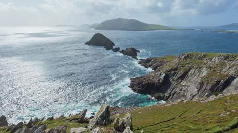
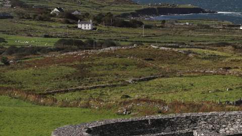
There's no better way to discover Kerry than by taking the scenic route.

One road follows the Atlantic past hidden beaches and seaside villages. Another climbs through mountain passes where you'll meet more sheep than cars. Others lead to historic castles, quiet viewpoints, walking trails and places you'll only find if you slow down.

Some of these routes are famous, like the Ring of Kerry and Slea Head Drive. Others, such as the North Kerry Cliff Coastal Drive and Ballaghisheen Pass, are the kind of roads locals quietly recommend—the ones where you can pull in for a coffee, walk an almost empty beach or spend an hour exploring a place you hadn't planned to stop.

This guide brings together six of Kerry's most scenic journeys, from iconic touring routes to lesser-known drives that deserve a place on every itinerary. For each one, you'll find where to start, how long to allow, what to see along the way, and our suggestions for experiencing it at its best.

While these routes can be explored by car, many are just as rewarding by bicycle, and some are best experienced on foot or by traditional jaunting car. Taking your time gives you the chance to discover the villages, landscapes and local businesses that make Kerry so special.

So rather than asking how much you can fit into one day, ask yourself a different question.

How much of Kerry do you want to discover?

Cliffs Coastal Route - Hidden Gem

Back to Top of List

Route: Tralee → Fenit → Banna Strand → Ballyheigue → Ballyduff → Ballybunion → Ballylongford → Tarbert → Listowel → Finuge → Castleisland → Tralee

If you are searching for a quieter side of Kerry, this is the road to take.

The North Kerry Coastal Drive brings together some of the county's most rewarding discoveries — sweeping Atlantic beaches, dramatic cliff views, medieval castles, estuary landscapes and welcoming towns filled with local character.

From the shores of Tralee Bay to the Shannon Estuary, this route reveals a different side of Kerry, where coastal scenery meets rich heritage and every stop tells a story. It is a journey for those who want to look beyond the famous landmarks and discover the places that make this part of the county unique.
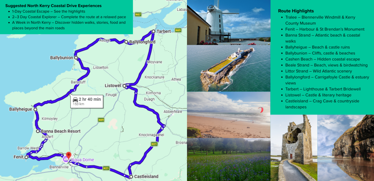
Tralee – Blennerville Windmill & Kerry County MuseumFenit – Harbour & St Brendan’s MonumentBanna Strand – Atlantic beach & coastal walksBallyheigue – Beach & castle ruinsBallybunion – Cliffs, castle & beachesCashen Beach – Hidden coastal escapeBeale Strand – Beach, views & birdwatchingLittor Strand – Wild Atlantic sceneryBallylongford – Carrigafoyle Castle & estuary viewsTarbert – Lighthouse & Tarbert BridewellListowel – Castle & literary heritageCastleisland – Crag Cave & countryside landscapes

Highlights Along the Route

Begin your journey along the shores of Tralee Bay, where the mountains meet the sea. Fenit is a beautiful coastal stop with views across the bay, scenic walking routes and the iconic Fenit Lighthouse standing proudly offshore. Continue towards Banna Strand, one of North Kerry's most loved beaches, where wide golden sands, Atlantic views and spectacular sunsets make it the perfect place to slow down and enjoy the coastline.

Further along the route, Ballyheigue offers a traditional seaside atmosphere with its long sandy beach and easy access to the dramatic scenery of Kerry Head, where panoramic views stretch across the Atlantic and Shannon Estuary. Continue through Ballyduff, a welcoming North Kerry village surrounded by countryside, where local traditions and community life remain at the heart of the landscape.

As the route reaches Ballybunion, the coastline becomes even more dramatic. Famous for its towering cliffs, sweeping beaches and Atlantic views, it is a place to take a coastal walk, explore the castle ruins or simply watch the waves below. Nearby Bromore Cliffs offer another spectacular viewpoint, often with fewer visitors and uninterrupted views of the ocean.

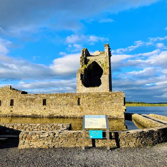
Continue towards Ballylongford, where history and nature come together at Carrigafoyle Castle, a remarkable medieval tower house overlooking the Shannon Estuary. Nearby Littor Beach provides a peaceful coastal escape, perfect for a quiet walk surrounded by open skies and estuary views.

Following the Shannon Estuary, Tarbert offers a natural gateway into North Kerry for visitors arriving by ferry from County Clare. The village has a strong connection to the sea, with harbour views, maritime heritage and the famous Tarbert–Killimer Ferry crossing linking Kerry with Clare. From here, the journey continues inland towards Listowel, Finuge and Castleisland, where the landscape gives way to a rich tapestry of stories, traditions and heritage — from literary connections and historic landmarks to the welcoming towns and villages that showcase the heart of North Kerry.


Experience It Slowly

There is no single way to experience the North Kerry Coastal Drive.

Spend a morning walking the sands of Banna Strand, explore the coastline around Ballybunion, step back in time at Carrigafoyle Castle, or take the route by bicycle to appreciate the changing landscapes between coast and countryside.

With welcoming villages, local cafés, historic sites and plenty of reasons to stop along the way, this is a journey that can easily become a highlight of your time in Kerry.

Give yourself time to explore, follow the road a little further, and discover the North Kerry experiences waiting beyond the map.

Off the Beaten Roads - Locals Best-Kept Secrets

Back to Top of List

Beyond Kerry’s famous coastal routes lie two quieter mountain journeys that reveal a different side of the county. Ballaghbeama Gap and Ballaghisheen Pass are often missed by visitors because they sit away from the main touring routes, but they offer some of Kerry’s most rewarding landscapes.

Located in the heart of the Iveragh Peninsula (Uíbh Ráthach), these remote mountain roads take you through peaceful valleys, rugged hills and landscapes shaped by nature over generations. They are not part of the traditional Ring of Kerry or Skellig Ring routes, but they offer a unique off-the-beaten-track Kerry experience — where rugged roads, remote valleys and dramatic mountain landscapes reveal a quieter, wilder side of the county.

Starting around the Glencar area, you can choose between two spectacular mountain crossings — each offering its own unforgettable experience.

Ballaghbeama Gap

Hidden in the heart of the Iveragh Peninsula, between Glencar and the Blackwater Valley, Ballaghbeama Gap is one of Kerry’s most spectacular and lesser-known mountain crossings. Surrounded by rugged peaks, open valleys and peaceful countryside, this narrow single-track road offers a true sense of wilderness. The route is best taken slowly and is more suited to confident drivers, with cycling or walking offering an ideal way to fully appreciate the scenery.

Once you reach the end of Ballaghbeama Gap, the adventure does not have to end there. The route connects naturally with some of most beautiful landscapes. Continue towards Moll’s Gap, where you will be rewarded with one of Kerry’s most famous mountain viewpoints overlooking the MacGillycuddy’s Reeks. From here, you can continue towards Killarney, explore Ladies View and the lakes, or travel onwards through the scenic mountain roads towards Kenmare.

Alternatively, follow the road towards Sneem, one of Kerry’s most colourful and welcoming villages. Known for its traditional streets, local shops, cafés and beautiful coastal setting, Sneem is a wonderful place to stop, relax and experience village life on the Ring of Kerry.

Travel times:

  • Ballaghbeama Gap to Moll’s Gap: approximately 15 minutes by car
  • Ballaghbeama Gap to Sneem: approximately 15 minutes by car
  • Moll’s Gap to Kenmare: approximately 25 minutes by car

Ballaghisheen Pass

Alternatively, from the Glencar area, continue towards Ballaghisheen Pass, a peaceful mountain crossing that leads towards Waterville and the southern side of the Iveragh Peninsula.

The route passes through wide valleys, open mountain landscapes and quiet countryside, offering a sense of space and tranquillity that feels far removed from the better-known routes. The viewpoint near the top of the pass provides beautiful views across the surrounding landscape before the road descends towards the Atlantic coast.

From Waterville, you can reconnect with the Ring of Kerry or to be a start Skellig Ring Route, explore the coastal scenery around Ballinskelligs Bay, or continue towards the Skellig Ring for more unforgettable views.

Travel Tip:
Some of these mountain routes are remote, with limited or no mobile phone signal or Wi-Fi. Roads can also be narrow with few passing places. Drive carefully, allow extra time, and consider exploring by bike or on foot to experience the landscapes at their best.

Skellig Ring

Back to Top of List

The Skellig Ring is where Kerry feels at its most dramatic.

Following the edge of the Iveragh Peninsula, this route brings together some of the county's most unforgettable coastal scenery, from wild Atlantic viewpoints and hidden beaches to ancient heritage sites and island landscapes.

Following the rugged western edge of the Iveragh Peninsula, the Skellig Ring is where Kerry feels at its most wild and unforgettable. The area is also the main gateway to Sceilg Mhichíl (Skellig Michael), the UNESCO World Heritage Site that rises dramatically from the Atlantic Ocean. While boat trips to the Skellig Islands are weather dependent and should be booked well in advance, simply seeing these iconic islands from the mainland is an unforgettable experience.

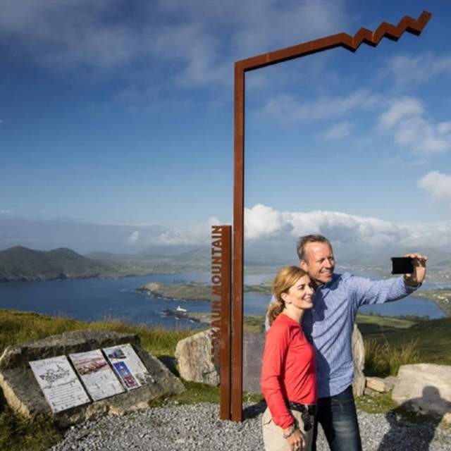
Travel through Cahersiveen (Cathair Saidhbhín), Ballinskelligs (Baile an Sceilg) and Portmagee (An Caladh), where colourful harbours, Gaeltacht traditions and local stories shape every stop along the route. Pause at Finian's Bay, admire the breathtaking views from the Kerry Cliffs (Aillte Chiarraí) and explore Valentia Island, where dramatic landscapes meet fascinating history. From the panoramic views atop Geokaun Mountain and Cliffs to the colourful harbour village of Knightstown, Valentia is a destination worth exploring in its own right. During the season, you can return to the mainland via the ferry from Knightstown to Renard Point near Cahersiveen, completing the journey without retracing your route.

The Skellig Ring is a place of hidden wonders, wild beauty, rich history and unforgettable adventures. To help you experience the very best of this remarkable corner of Kerry, we've created a detailed Skellig Ring itinerary, packed with suggested stops, local experiences and must-see highlights. 

Slea Head Drive - Dingle Peninsula

Back to Top of List

One of Ireland's most iconic coastal drives, Slea Head Drive (Ceann Sléibhe) follows a spectacular 47 km loop around the western edge of the Dingle Peninsula (Corca Dhuibhne), where dramatic Atlantic scenery meets ancient history, rich culture and a thriving Irish language heritage.

Starting in Dingle (Daingean Uí Chúis), the route winds past golden beaches, rugged cliffs, prehistoric sites and breathtaking viewpoints overlooking the Blasket Islands (Na Blascaodaí). As you travel through the peninsula's Gaeltacht, you'll notice Irish being spoken more frequently than in many other parts of the country, adding to the area's unique sense of place and living culture.

Along the way, discover highlights including Ventry Beach, Coumeenoole Beach, Dunquin Pier, Clogher Strand and the traditional village of Ballyferriter (Baile an Fheirtéaraigh), where local music, heritage and traditions remain at the heart of community life. Take your time to stop, walk the beaches, explore ancient sites and enjoy fresh local food in Dingle.

If you'd rather leave the driving to someone else, you can also experience the route on the Dingle Open Top Bus Tour. This guided journey showcases the spectacular scenery with stops at many of Slea Head's best-known attractions, allowing you to relax and enjoy the views along the way.

The Slea Head Drive is one of Ireland’s most iconic coastal routes, circling the western tip of the Dingle Peninsula. The drive follows dramatic cliff edges and Atlantic viewpoints, passing ancient sites, traditional villages, and sweeping views towards the Blasket Islands.

Ring of Kerry

Back to Top of List

The Ring of Kerry is one of Ireland’s most famous scenic routes, and for good reason. This unforgettable journey brings together everything that makes Kerry special — dramatic mountains, beautiful beaches, colourful villages, historic landmarks and some of the country’s most spectacular coastal views.

Often starting in Killarney (Cill Airne), the route takes you through the heart of the Iveragh Peninsula (Uíbh Ráthach), where every section reveals a different landscape. From the lakes and mountains of Killarney National Park to Atlantic viewpoints, quiet beaches and charming villages along the coast, the Ring of Kerry offers a true taste of the county’s natural beauty and heritage.

Highlights include Ladies View, Moll’s Gap, Rossbeigh Beach, Waterville, Sneem, Cahersiveen and the many viewpoints looking across the Atlantic. Along the way, discover ancient forts, local food producers, walking routes and welcoming communities that make the journey as memorable as the scenery itself.

While the route can technically be completed in a day, the real magic of the Ring of Kerry comes from taking your time. Allow several days — or even longer — to explore the beaches, villages, walks and hidden stops that are easy to miss when travelling too quickly.

The Ring of Kerry is more than a scenic drive; it is a journey through the landscapes, stories and experiences that have made Kerry one of Ireland’s most loved destinations.

The Ring of Kerry is by far the most famous Day Tour in Ireland, if destinations received Oscars then this tour would be nominated each year. Throughout its 216 kilometres, you will travel around the magnificent MacGillicuddy Reeks Mountain Range and the Iveragh Peninsula, along the breath-taking…

Gap of Dunloe

Back to Top of List

The Gap of Dunloe is one of Kerry’s most spectacular mountain landscapes, where towering peaks, glacial lakes and winding paths create an experience that feels untouched by time.

Some visitors choose to drive through the Gap, and the views from the road are undoubtedly beautiful. However, this is a landscape best experienced at a slower pace. Walking, cycling or travelling by traditional jaunting car allows you to truly take in the scale of the mountains, hear the sounds of nature around you and appreciate the changing views at every turn.

Located between the MacGillycuddy’s Reeks (Na Cruacha Dubha) and the Purple Mountain, the route passes through dramatic valleys, peaceful lakes and some of the most breathtaking scenery in Killarney National Park (Páirc Náisiúnta Chill Airne).

Take time to stop, look around and enjoy the feeling of being surrounded by Kerry’s wild beauty. From the mountain lakes to the remote landscapes of the Black Valley, the Gap of Dunloe is not simply a road to travel — it is a place to experience.

Visitor Tip:
The roads through the Gap of Dunloe are narrow and shared with walkers, cyclists and traditional jaunting cars. For a more relaxed and enjoyable experience, we highly recommend exploring the route on foot, by bicycle or by jaunting car, allowing you to take in the scenery safely and fully appreciate the beauty of this spectacular mountain landscape.